Others seem designed by a madman with a vendetta against suspension systems.
America’s highway network harbors some particularly treacherous stretches.
We’ve identified the 20 most notorious offenders.
If your idea of excitement involves white-knuckle driving, near-misses with eighteen-wheelers, and playing pothole roulette, you’re in for a treat.
Buckle up – we’re about to explore America’s automotive nightmares.
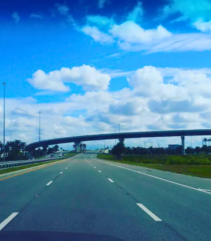
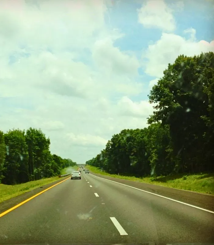
1. I-4, Florida

Slicing through Florida’s midsection from Tampa to Daytona Beach, this 132-mile corridor of chaos has earned its grim reputation.
The stretch through Orlando combines tourist confusion, commuter aggression, and frequent construction zones into a perfect storm of vehicular mayhem.
Locals call it the “I-4 Dead Zone” for reasons that become apparent during rush hour.
[MOST DANGEROUS ROAD IN THE U.S.]: It had 1.134 deaths per mile and 150 total deaths from 2016 to 2019.
2. I-45, Texas

Connecting Galveston’s coastal charm to Dallas’s urban sprawl, this 285-mile Texas titan passes through Houston’s concrete jungle where survival of the fittest applies to daily commutes.
The combination of aggressive driving culture, frequent construction, and unpredictable weather patterns creates a uniquely Texan brand of roadway roulette.
Even longtime locals approach certain sections with dread.
[A DEADLY STRETCH OF ROAD]: This route had 0.913 deaths per mile and 260 total deaths from 2016 to 2019.
3. US 192, Florida
Stretching 75 miles from Four Corners to Indialantic, this Florida thoroughfare serves as a cautionary tale of tourism infrastructure gone wrong.
The Kissimmee section creates a perfect storm of distracted tourists, confusing signage, and countless entry/exit points from attractions and hotels.
Locals have developed elaborate detour systems just to avoid this notorious stretch during peak seasons.
[A DANGEROUS FLORIDA HIGHWAY]: It had 0.867 deaths per mile and 65 total deaths from 2016 to 2019.
4. I-17, Arizona
This 146-mile mountain passage connecting Phoenix to Flagstaff transforms from scorching desert straightaways to white-knuckle mountain curves with alarming suddenness.
Dramatic elevation changes, extreme temperature variations, and unexpected wildlife crossings create a uniquely Southwestern brand of driving danger.
The Phoenix metro section combines urban congestion with desert heat that regularly tests both vehicles and driver patience.
[ARIZONA’S HIGH-RISK HIGHWAY]: It saw 0.707 deaths per mile and 103 total deaths from 2016 to 2019.
5. US 92, Florida
US 92’s 177-mile journey from St. Petersburg to Daytona Beach showcases Florida’s unique traffic ecosystem at its most chaotic.
This east-west corridor serves as a perfect case study in how mixing retirees, tourists, commuters, and commercial vehicles creates unpredictable and often dangerous driving conditions.
Tampa’s sections feature particularly notorious intersections where locals say traffic laws are treated more like suggestions.
[ANOTHER FLORIDA HAZARD]: The highway had 0.706 deaths per mile and 125 total deaths from 2016 to 2019.
6. I-12, Louisiana

This 86-mile Louisiana lightning rod connects Baton Rouge to Slidell, proving that good things don’t always come in small packages.
What I-12 lacks in length, it makes up for in hazardous conditions, including frequent flooding, poor visibility during storms, and infrastructure that seems perpetually under construction.
Local drivers have developed a unique sixth sense for navigating its notorious blind merges and sudden slowdowns.
[SHORT BUT DEADLY]: With 0.666 deaths per mile and 57 total deaths between 2016 and 2019, it’s a major risk zone.
7. I-30, Arkansas/Texas

This 367-mile corridor connecting Aledo, Texas to North Little Rock, Arkansas serves as a masterclass in interstate inconsistency.
The road’s personality shifts dramatically as it crosses state lines, with Texas sections featuring aggressive high-speed traffic and Arkansas portions plagued by unexpected construction zones.
Dallas drivers approach certain interchanges with the same caution one might use handling explosives.
[HIGHWAY WITH TROUBLE IN TEXAS]: It saw 0.646 deaths per mile and 237 total deaths from 2016 to 2019.
8. I-95, Various States

Stretching 1,908 miles from Miami to Maine, I-95 is America’s coastal colossus of chaos, a veritable sampler platter of driving nightmares.
Each state section has its own unique flavor of danger – from Florida’s tourist-laden congestion to the Northeast’s aggressive commuter culture.
Jacksonville’s notorious section combines high speeds, heavy commercial traffic, and frequent tropical downpours into a particularly hazardous cocktail.
[AMERICA’S COASTAL DEATH STRIP]: It had 0.637 deaths per mile and 1,215 total deaths from 2016 to 2019.
9. I-19, Arizona
This compact 63-mile connection between Nogales and Tucson proves that deadly roads come in small packages.
What makes this short stretch particularly treacherous is its unique combination of cross-border traffic, desert conditions that create sudden visibility issues, and dramatic temperature fluctuations.
Sahuarita’s section has developed such a reputation that locals have created informal rules for navigating its most problematic interchanges.
[A SHORT YET DEADLY ROUTE]: This road had 0.631 deaths per mile and 40 total deaths from 2016 to 2019.
10. I-85, Various States
Spanning 666 miles from Montgomery, Alabama to Petersburg, Virginia, this interstate’s ominous mileage count seems fitting given its safety record.
The highway transforms as it crosses state lines, with each section presenting unique challenges from Alabama’s rural high-speed zones to North Carolina’s congested urban corridors.
Charlotte’s notorious section combines heavy commuter traffic with complex interchanges that confuse even seasoned locals.
[A SOUTHEASTERN DANGER ZONE]: It had 0.613 deaths per mile and 408 total deaths from 2016 to 2019.
11. I-5, Various States

This 1,381-mile West Coast wanderer connects San Ysidro, California to Blaine, Washington, showcasing nearly every driving hazard imaginable along the way.
From Southern California’s notorious congestion to the Pacific Northwest’s visibility-challenging rain, I-5 is a coast-long catalog of caution.
Los Angeles sections feature a perfect storm of dense traffic, aggressive driving, and complex interchanges that routinely bring travelers to a standstill.
[WEST COAST TROUBLE SPOT]: It had 0.609 deaths per mile and 841 total deaths from 2016 to 2019.
12. I-10, Various States

Spanning 2,460 miles from Santa Monica, California to Jacksonville, Florida, I-10 serves as America’s southern scar, cutting across the continent’s midsection with reckless abandon.
This transcontinental terror transforms dramatically across its journey – from California’s congested urban corridors to Texas’s high-speed rural stretches to Florida’s tourist-laden coastal sections.
Houston and El Paso compete for the dubious honor of hosting the most hazardous segments.
[CROSS-COUNTRY DANGER ZONE]: This road had 0.597 deaths per mile and 1,469 total deaths from 2016 to 2019.
13. I-20, Various States
This 1,539-mile southern staple connects Scroggins Draw, Texas to Florence, South Carolina, offering a masterclass in interstate inconsistency along the way.
The highway’s personality shifts dramatically as it crosses state lines – from Texas’s wide-open speedways to Georgia’s congested urban corridors.
Dallas hosts particularly problematic sections where complex interchanges, construction zones, and aggressive driving create a perfect storm of potential incidents.
[A SOUTHERN DEAD ZONE]: It saw 0.549 deaths per mile and 845 total deaths between 2016 and 2019.
14. I-35W, Texas

This 85-mile Texas troublemaker connecting Hillsboro to Denton packs an impressive amount of danger into its modest length.
The highway serves as a textbook example of how rapid urban growth can outpace infrastructure, creating a perfect storm of commuter congestion, commercial traffic, and construction zones.
Fort Worth sections feature particularly notorious interchanges where locals say a prayer before merging.
[SHORT ROUTE, HIGH RISK]: With 0.528 deaths per mile and 45 total deaths, it’s one of the worst in the state.
15. I-24, Illinois/Tennessee
This 317-mile Midwest menace connects Pulleys Mill, Illinois to East Ridge, Tennessee, offering a crash course in interstate inconsistency.
The highway’s personality transforms dramatically as it crosses state lines, with Illinois’s rural high-speed zones giving way to Tennessee’s congested urban corridors.
Nashville sections combine heavy commuter traffic, tourist confusion, and complex interchanges into a particularly hazardous blend.
[A DANGEROUS MIDWEST TO SOUTH LINK]: This route had 0.527 deaths per mile and 167 total deaths from 2016 to 2019.
16. I-75, Various States

This 1,786-mile monster stretches from Miami Lakes, Florida to Sault Ste. Marie, Michigan, offering a veritable tour of America’s most challenging driving conditions.
The interstate’s personality shifts dramatically as it traverses diverse regions – from Florida’s tourist-heavy corridors to Michigan’s winter wonderland of white-knuckle driving.
Atlanta’s notorious section combines complex interchanges, perpetual construction, and aggressive commuters into a particularly hazardous blend.
[A LONG AND DEADLY ROUTE]: With 0.521 deaths per mile and 930 total deaths, I-75 ranks high for danger.
17. I-83, Maryland/Pennsylvania

This compact 85-mile connector linking Baltimore, Maryland to Progress, Pennsylvania proves that deadly roads don’t need length to leave an impression.
The highway’s narrow lanes, limited shoulders, and frequent congestion create a uniquely challenging driving environment, particularly during inclement weather.
Baltimore’s urban section features a perfect storm of aggressive commuters, complex interchanges, and aging infrastructure that keeps emergency services on constant alert.
[DEADLY MILES IN MARYLAND]: It had 0.506 deaths per mile and 43 total deaths from 2016 to 2019.
18. I-26, Tennessee/South Carolina
This 305-mile southeastern serpent connects Kingsport, Tennessee to Charleston, South Carolina, showcasing the region’s unique driving challenges along the way.
The highway transforms dramatically as it traverses the Appalachian Mountains before descending into South Carolina’s coastal plain, creating a Jekyll-and-Hyde driving experience.
North Charleston’s section combines port traffic, tourist confusion, and complex interchanges into a particularly hazardous cocktail.
[A SOUTHEASTERN DANGER STRIP]: The road saw 0.496 deaths per mile and 151 total deaths from 2016 to 2019.
19. I-35E, Texas

This 97-mile Texas troublemaker parallels its western twin I-35W, connecting Hillsboro to Denton through some of the state’s most challenging driving territory.
The highway serves as a case study in how urban sprawl creates unique traffic challenges, with sections through Dallas featuring a perfect storm of commuter congestion, construction zones, and complex interchanges.
Locals have developed elaborate alternative routes just to avoid its most notorious sections during peak hours.
[DOUBLE TROUBLE IN TEXAS]: It had 0.496 deaths per mile and 48 total deaths from 2016 to 2019.
20. US 199, California/Oregon

This 80-mile mountain passage connecting Crescent City, California to Grants Pass, Oregon proves that scenic routes can hide deadly secrets.
The highway’s narrow lanes, sharp curves, and dramatic elevation changes create a white-knuckle driving experience that demands complete attention.
Grants Pass sections combine challenging terrain with unpredictable weather conditions that can transform a pleasant drive into a survival exercise within minutes.
[A CURVY ROAD WITH BIG RISKS]: This road had 0.488 deaths per mile and 39 total deaths from 2016 to 2019.